Difference between revisions of "Dromedary Upper"
From wiki new
| Line 15: | Line 15: | ||
dromedary upper map large.jpg</gallery> | dromedary upper map large.jpg</gallery> | ||
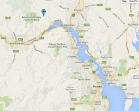
| − | * to view a larger map of the locality, please 'click' | + | * to view a larger map of the locality, please 'click' once on the RH image above |
Latest revision as of 20:27, 3 June 2014
OPENED: 12 Oct 1925 · CLOSED: 29 Jun 1946
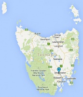
Location: Dromedary Upper is located 3km north-west of Dromedary at 42° 43' 0" South, 147° 9' 0" East
- Nearby post offices included Dromedary and Bridgewater.
- to view a larger map of the locality, please 'click' once on the RH image above
Datestamp[edit]
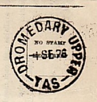
Type 4
- Earliest recorded date: 17 May 1926 · Latest recorded date: 29 Nov 1945
- The Type 4 cds is rated RRR
Report an earlier or later use of the Type 4 datestamp here
| To the Index of Tasmanian Post Offices and Postal Markings
To the Tasmanian Datestamp Types main page |
Other Information[edit]
Links & References[edit]
| To the Index of Tasmanian Post Offices and Postal Markings
To the Tasmanian Datestamp Types main page |
Please contact the author of this listing GRD to report any errors and/or omissions or to provide better or 'missing' images, etc.


