Difference between revisions of "Rosebery"
From wiki new
| Line 6: | Line 6: | ||
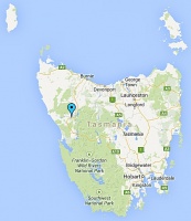
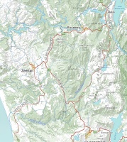
| − | '''Location: ''' | + | '''Location: situated approx. 20km NE of [[Zeehan]] and 8.5km SW of [[Tullah]] at 41° 47' 0" South, 145° 31' 0" East ''' |
| − | * | + | * some of the closest post offices to Rosebery were/are located at '''[[Tullah]]''', '''[[Williamsford]]''' and '''[[Renison Bell]]''' |
| − | |||
| − | |||
<gallery widths=200px heights=200px>file:rosebery map small.jpg | <gallery widths=200px heights=200px>file:rosebery map small.jpg | ||
| Line 16: | Line 14: | ||
* to enlarge either map, 'click' on the image once | * to enlarge either map, 'click' on the image once | ||
| − | |||
Revision as of 04:07, 5 June 2014
OPENED: 1 NOV 1896 · CURRENT STATUS: OPEN (Licensed Post Office) · POSTCODE: 7470
Location: situated approx. 20km NE of Zeehan and 8.5km SW of Tullah at 41° 47' 0" South, 145° 31' 0" East
- some of the closest post offices to Rosebery were/are located at Tullah, Williamsford and Renison Bell
- to enlarge either map, 'click' on the image once
POSTMARKS and POSTAL MARKINGS
| 1) Rosebery - Barred Numeral Postmark | 2) Rosebery - Steel Circular Datestamps | 3) Rosebery - Rubber/Neoprene Datestamps | 4) Rosebery - Other Cancellations |
| To the Main Page (Index)
To the Tasmanian Datestamp Types page |
OTHER INFORMATION
LINKS and REFERENCES
Please contact the author of this listing to report any errors and/or omissions or to provide better or 'missing' images, etc.

