Difference between revisions of "Elizabeth Town"
From wiki new
| (One intermediate revision by the same user not shown) | |||
| Line 24: | Line 24: | ||
'''Second Allocation BN28''' | '''Second Allocation BN28''' | ||
| − | <gallery widths=200px heights=200px>File: elizabeth town bn28.jpg </gallery> | + | <gallery widths=200px heights=200px>File: elizabeth town bn28.jpg |
| + | Bn28_elizabeth_town.jpg</gallery> | ||
Latest revision as of 23:59, 9 June 2014
Location:
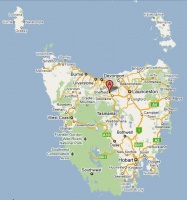
- situated 11km west of Deloraine at 41° 27' 0" South, 146° 34' 0" East
see Google Map for an enlargement
Opened: 1-Sep-1860 · Closed: 30-Sep-1969
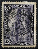
Barred Numeral Postmark[edit]
Second Allocation BN28
Rated:
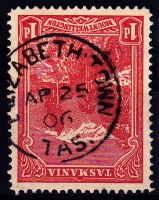
Datestamps[edit]
Type 1a
- Earliest recorded date: 5-May-1896· Latest recorded date: 13-Oct-1933
Report an earlier or later use of the Type datestamp here
Type 4a
- Earliest recorded date: 23-May-1934 · Latest recorded date: 2-Mar-1965
Report an earlier or later use of the Type datestamp here
Type 4a(s)
- Earliest recorded date: 12-May-1965 · Latest recorded date: 30-Sep-1969
Report an earlier or later use of the Type datestamp here
| To the Index of Tasmanian Post Offices and Postal Markings
To the Tasmanian Datestamp Types main page |
Other Information[edit]
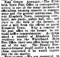
- Article from July 1902 relating to perceived poor location of the Elizabeth Town post office.
Links & References[edit]
| To the Index of Tasmanian Post Offices and Postal Markings
To the Tasmanian Datestamp Types main page |
Please contact GRD of this page to report any errors and/or omissions or to provide better or 'missing' images, etc.
