Difference between revisions of "Wattle Grove"
From wiki new
m (1 revision) |
|
(No difference)
| |
Latest revision as of 14:28, 4 September 2013
Location:
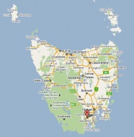
- situated 22km south of Huonville at 43° 10' 0" South, 147° 2' 0" East
- nearby post offices have included Glazier's Bay, Wattle Grove Lower and Cygnet
see Google Map for an enlargement
Opened: 11-MAY-1889 · Closed: 7-FEB-1967
Barred Numeral Postmark[edit]
Second Allocation BN296
Allocated BN296
Rated: RRR
Datestamps[edit]
- Earliest recorded date: 10-SEP-1892 · Latest recorded date: 8-JAN-1934
- Rated R during the Commonwealth period
Report an earlier or later use of the Type datestamp here
- Earliest recorded date: 19-JUL-1934 · Latest recorded date: 6-FEB-1967
- Rated RR
- The post office burned down on 7-FEB-1967 and never reopened. The type 5s CDS which has been manufactured never came into use.
Report an earlier or later use of the Type datestamp here
| To the Index of Tasmanian Post Offices and Postal Markings
To the Tasmanian Datestamp Types main page |
Other Information[edit]
Links & References[edit]
| To the Index of Tasmanian Post Offices and Postal Markings
To the Tasmanian Datestamp Types main page |
Please contact the author of this page to report any errors and/or omissions or to provide better or 'missing' images, etc.
