Farrell Siding
From wiki new
OPENED: 15 MAY 1907 · CLOSED: 2 DEC 1908
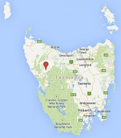
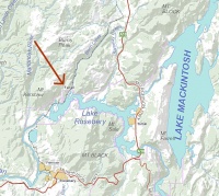
Location: situated on the Emu Bay Railway approx. 6kms NW of Tullah and 7.5km NNE of Rosebery at 41° 42.76'N 145° 32.78'E
- for an enlargement, 'click' on either map once
Datestamp
- Earliest recorded date: · Latest recorded date:
Report an earlier or later use of the Type datestamp here
| To the Index of Tasmanian Post Offices and Postal Markings
To the Tasmanian Datestamp Types main page |
Other Information
Links & References
- an interesting and detailed article about the North Mt.Farrell Tramway can be found here
| To the Index of Tasmanian Post Offices and Postal Markings
To the Tasmanian Datestamp Types main page |
Please contact the author of this listing to report any errors and/or omissions or to provide better or 'missing' images, etc.


