Waratah
From wiki new
Location:
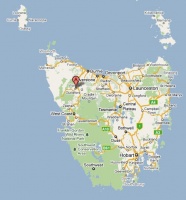
- situated 64km south of Burnie at 41° 27' 0" South, 145° 32' 0" East
see Google Map for an enlargement
Opened (as Mt Bischoff): 1-SEP-1874 · OPEN
- Name changed to Waratah 1-JAN-1882
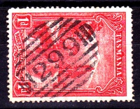
Barred Numeral Postmark
Second Allocation BN299
Allocated BN299 from 1889
Datestamps
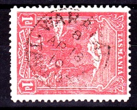
Type 1 solid stops
- Earliest recorded date: 24-JAN-1883 · Latest recorded date: 11-OCT-1934
- Found with both code 8 (very common) and no code (less common)
Report an earlier or later use of the Type datestamp here
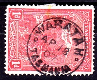
Type 1 circle stops
- Earliest recorded date: 5-JAN-1899 · Latest recorded date: 10-NOV-1914
- Found in green/blue 1901-1902
- Found in blue 1909
Report an earlier or later use of the Type datestamp here
- Earliest recorded date: 19-DEC-1914 · Latest recorded date: 16-APR-1969
Report an earlier or later use of the Type datestamp here
- Earliest recorded date: 28-APR-1969 · Latest recorded date: In use 1995
Report an earlier or later use of the Type datestamp here
- Earliest recorded date: 4-SEP-1987 · Latest recorded date: In use 1995
Report an earlier or later use of the Type datestamp here
| To the Index of Tasmanian Post Offices and Postal Markings
To the Tasmanian Datestamp Types main page |
Other Information
Links & References
| To the Index of Tasmanian Post Offices and Postal Markings
To the Tasmanian Datestamp Types main page |
Please contact the author of this page to report any errors and/or omissions or to provide better or 'missing' images, etc.


