Naracoopa
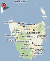
Location: 39° 55' 0" South, 144° 6' 0" East
- situated on King Island approx. 23 km east of Currie and approx. 15km NNE of Grassy
see Google Map for an enlargement
- Opened: 07-JAN-1918 as a Telephone Office
- Upgraded to a Receiving house from 01-DEC-1920 and then to an Agency from 01-JUL-1923
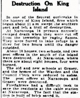
- Post Office was destroyed by fire on 30-JAN-1939 (see contemporary newspaper report below)
- Closed: 19-SEP-1962
Contents
[hide]Datestamps[edit]
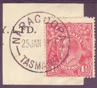
- Earliest recorded date: 19-APR-1921 · Latest recorded date: 31-DEC-1938
- Rated RR
This datestamp was ordered on 19-DEC-1920 and was in use until destroyed when the office burnt down in 1939
Relief Stamp 2 was used as a temporary replacement: ERD: 03-FEB-1939 LRD: 05-APR-1939
Report an earlier or later use of the Type 2d datestamp here
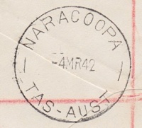
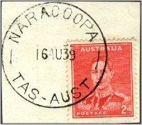
- Earliest recorded date: 04-MAY-1939 · Latest recorded date: 06-APR-1959
- Rated RR
Report an earlier or later use of the Type 5 datestamp here
| To the Index of Tasmanian Post Offices and Postal Markings
To the Tasmanian Datestamp Types main page |
Other Cancellations and Postal Items[edit]
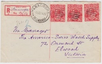
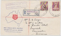
- The origin of the 7 bar 'killer' cancellation on the 1925 cover illustrated above is unknown. It was possibly used to cancel mail at either
of the Telephone Offices at Fraser Road West or Pegarah Road as mail from both localities was transmitted via Naracoopa at the time.
- Red R.6 registration label
Other Information[edit]
- Report regarding the destruction of the post office by fire published in The Mercury on Tuesday 31-JAN-1939
(it is interesting that a post office at Grassy is mentioned in the report as there was no office in operation there between 1935 and 1943)
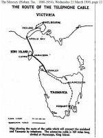
- Map of the Bass Strait telephone cable which was laid from Apollo Bay in Victoria to Circular Head via Naracoopa
Links & References[edit]
| To the Index of Tasmanian Post Offices and Postal Markings
To the Tasmanian Datestamp Types main page |
Please contact the author of this page to report any errors and/or omissions or to provide better or 'missing' images, etc.
